

Seefin Mountain W Top [Seefin Mountain] [Sui Finn]
Good walks are even better shared.
Overview
Seefin Mountain W Top [Seefin Mountain] [Sui Finn]
Seefin Mountain W Top, known affectionately by locals as just Seefin, is not just another peak in the Knockmealdown Mountains; it's a glorious piece of the Irish landscape that invites hikers into its embrace.
Geology
The mountain primarily showcases sedimentary rocks such as sandstone and shale. These formations have weathered the test of time, offering a rough yet beautiful texture to the scenery. Each crag tells a story of geological history shaped over millions of years.
Summit Features
When you reach the summit, you'll be greeted by a sturdy cairn that stands proudly against the backdrop of the sky. This is the perfect spot for a well-earned photo op! Plus, you can take a good look at the stunning rock formations scattered about which showcase nature's raw artistry.
Terrain
The journey to Seefin can be a bit of a mixed bag when it comes to terrain. Expect rocky paths that will challenge your footing, grassy areas perfect for a quick snack break, and boggy patches that might just surprise you. Make sure you lace up your hiking boots to keep your feet safe from any sneak attacks by mud!
Views
The highlight of your trek will undoubtedly be the views from the top. On a clear day, the sight of the stunning Knockmealdown Mountains spread out before you is simply breathtaking. You might even get a glimpse of the Waterford coastline, reminding you just how vast and beautiful this emerald isle is. Spring and early autumn are the best times to visit if breathtaking views are your goal.
Hazards
As with any adventure in the hills, there are a few hazards to keep in mind. Slippery rocks and unexpected fog can make things a little dicey. Stick to marked paths to avoid the treacherous hidden bogs that might be lurking around.
Nearby Summits
You're never short of options up here! Nearby summits include Knockmealdown, standing tall at 794 meters, and the Galty Mountains, which reach an impressive 919 meters. Why not tackle them all?
Access
Finding your way to Seefin is convenient, especially with a small parking area along R676. Just be sure to arrive early to nab a space before the crowd rolls in! If you’re relying on public transportation, do check schedules beforehand; those buses aren’t always on time—a friendly local can lend a hand, perhaps?
Facilities
While Clogheen offers a few delightful cafes and shops to recharge, toilet facilities are scarce. Make sure your journey starts with a well-planned pit stop!
History
The name 'Seefin' is steeped in local lore. It may derive from the Gaelic 'Sídhe Fhionn', meaning 'the fairies' hill', which adds a bit of enchantment to your journey. Exploring Seefin isn't just a hike; it’s treading on the sacred ground of stories sung over ages!
So pack your bags, bring your sense of adventure, and head out to Seefin Mountain W Top where every step is a leap into Ireland’s incredible natural beauty. Happy hiking!
Explore routes near Seefin Mountain W Top [Seefin Mountain] [Sui Finn]
Public walks starting within 80 km of this hill. Nearby does not mean a route reaches the summit; check its map and access before setting out.
No public routes are currently listed within 80 km of Seefin Mountain W Top [Seefin Mountain] [Sui Finn] on Walkmates. This does not mean there are no paths here. Explore the map and check local access information before planning a walk.
Route planning notes
These notes describe possible approaches, not verified navigable routes or permission to cross land. Check current paths, local access rules and conditions before setting out.
The Scenic Loop from the R676
A delightful loop that offers varying terrain and splendid views, starting from the R676 road.
The Direct Ascent from Sui Finn
Take on the challenge with a direct ascent from the village of Sui Finn, showcasing sweeping views along the way.
Make a day of it, together
Find someone to share the walk with, or organise a day out along a route you like.
Photo Gallery
View all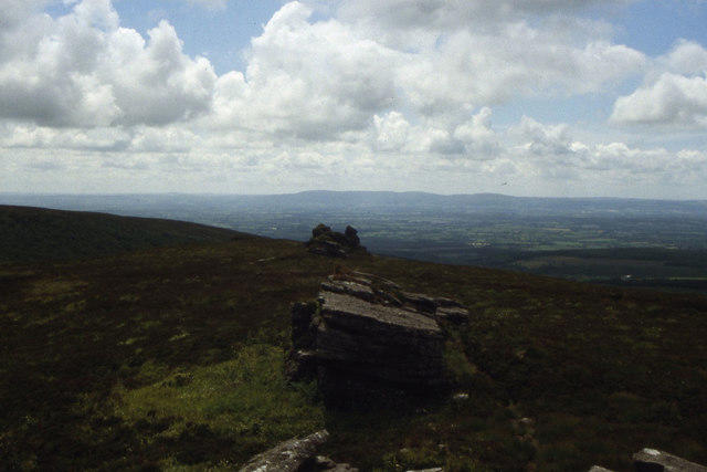 Photo could not load
R6417 : Seefin Mountain summit - View S along summit ridge
Colin Park
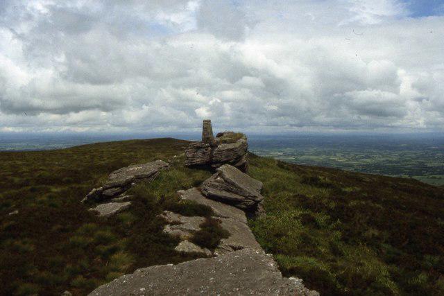 Photo could not load
R6418 : Seefin Mountain summit & trig point
Colin Park
Hill facts and local notes
Classifications
Elevation
528m
1,732 ft
Prominence
383m
Coordinates
52.3136, -8.5219
R644180
OS Map
73
At the Summit
At the summit, you'll find a well-positioned cairn alongside a great view of the neighbouring mountains. Look out for the impressively-sized rock formations.
Terrain & Geology
Primarily composed of sedimentary rocks, including sandstone and shale, which form the rugged yet picturesque landscapes typical of the region.
Views & Scenery
Panoramic views of the Knockmealdown Mountains, and on a clear day, you can even spot the coastline of Waterford.
History & Heritage
Name Origin
The name 'Seefin' may derive from the Gaelic term 'Sídhe Fhionn', meaning 'the fairies' hill', adding a hint of folklore to your adventure.
Historical Significance
Seefin Mountain has historical significance linked to local legend and culture, often represented in tales of ancient Irish folklore.
Getting There & Facilities
Check current local access restrictions, parking rules and transport timetables before travelling. These notes do not confirm public access to the summit.
Parking
There is a small parking area available near the starting point on the R676. Arrive early to secure a spot.
Public Transport
Local bus services operate from nearby towns, though service may be infrequent. Consider combining your visit with a carpool.
Nearby Facilities
Cafes and small shops are found in Clogheen, though public toilets are limited, so be prepared!
Safety Information
Known Hazards
- Be mindful of slippery rocks and thick fog that can roll in unexpectedly. Ensure to stay on marked paths to avoid any hidden bogs!
General Safety Tips
- Check weather conditions before setting out
- Carry appropriate clothing and equipment
- Let someone know your planned route
- Take a map, compass, and GPS device
- Carry emergency supplies: food, water, first aid kit, torch
Hills
Some common questions about the hills answered
Are there group walks up Seefin Mountain W Top [Seefin Mountain] [Sui Finn]?
Many walkers use Walkmates to join or organise walks with others. You can check for group walks around Seefin Mountain W Top [Seefin Mountain] [Sui Finn] through the maps
Are there other walkers around Seefin Mountain W Top [Seefin Mountain] [Sui Finn]?
Activity varies by location and time, but Walkmates lets you see whether others have shared walks or shown interest in this area. Find other people through the walking friends search walking friends for Seefin Mountain W Top [Seefin Mountain] [Sui Finn] search or of course create your own walk for Seefin Mountain W Top [Seefin Mountain] [Sui Finn]
Can I organise a walk to Seefin Mountain W Top [Seefin Mountain] [Sui Finn]?
Yes. If there aren’t any walks listed already, you can create a walk and make it available for others to join.
If you're signed up to Walkmates, you can create a walk to Seefin Mountain W Top [Seefin Mountain] [Sui Finn].
How do I find a walk up this hill?
There are often multiple ways to walk this hill, depending on experience and route preference. Walkmates helps you explore walks and routes that others have shared.
Can I suggest a new route up Seefin Mountain W Top [Seefin Mountain] [Sui Finn]?
Yes. You can suggest or create routes to share with others. Walkmates focuses on the social side of walking, so routes are used to help people organise walks and explore areas together, rather than as detailed navigation tools or route libraries.
Other uses really appreciate knowledgeable walkers sharing their routes. Share your favourite route to Seefin Mountain W Top [Seefin Mountain] [Sui Finn] here
The is an error or something incorrect about this hill. How do I let you know?
We always strive to keep the information on Walkmates as accurate as possible. If you find an error, please let us know through the contact form and we'll aim to correct it as quickly as possible
Community Discussion
Comments
Location
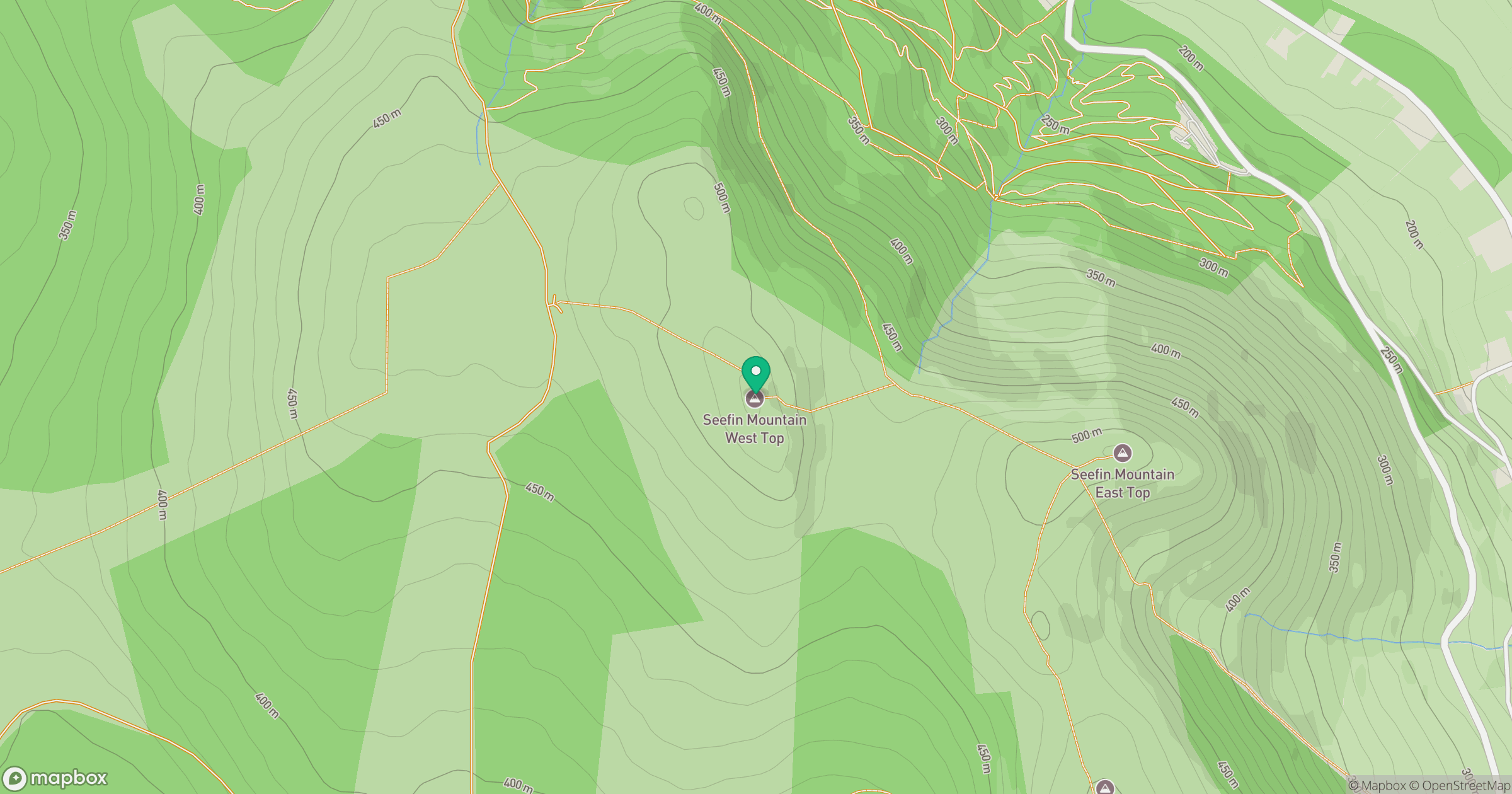
Grid reference: R644180
View on OpenStreetMapOpens a map in a new tab, centred on the hill.
Hills within 30 km
Straight-line distance, not a walking route or confirmation of access.
Galtymore [Cnoc Mor na nGaibhlte]
918m
Coolfree Mountain [Sliabh Chuil Fhraoigh]
437m
Carrigeenamronety [Carraigin na mBrointe]
401m
Fear Breagach
369m
Slievereagh [The Pinnacle] [An Sliabh Riabhach]
464m
No comments yet. Be the first.